

Abstract
Over the past 50 years, human water use has more than doubled and affected streamflow over various regions of the world. However, it remains unclear to what degree human water consumption intensifies hydrological drought (the occurrence of anomalously low streamflow). Here, we quantify over the period 1960–2010 the impact of human water consumption on the intensity and frequency of hydrological drought worldwide. The results show that human water consumption substantially reduced local and downstream streamflow over Europe, North America and Asia, and subsequently intensified the magnitude of hydrological droughts by 10–500%, occurring during nation- and continent-wide drought events. Also, human water consumption alone increased global drought frequency by 27 (±6)%. The intensification of drought frequency is most severe over Asia (35 ± 7%), but also substantial over North America (25 ± 6%) and Europe (20 ± 5%). Importantly, the severe drought conditions are driven primarily by human water consumption over many parts of these regions. Irrigation is responsible for the intensification of hydrological droughts over the western and central US, southern Europe and Asia, whereas the impact of industrial and households' consumption on the intensification is considerably larger over the eastern US and western and central Europe. Our findings reveal that human water consumption is one of the more important mechanisms intensifying hydrological drought, and is likely to remain as a major factor affecting drought intensity and frequency in the coming decades.
Export citation and abstract BibTeX RIS

Content from this work may be used under the terms of the Creative Commons Attribution 3.0 licence. Any further distribution of this work must maintain attribution to the author(s) and the title of the work, journal citation and DOI.
1. Introduction
Drought is a natural phenomenon caused by below-normal precipitation over a prolonged period (Tallaksen and van Lanen 2004, Wilhite 2000, Mishra and Singh 2010). Lack of precipitation causes a meteorological drought, but results in a hydrological drought as it propagates into more extensive areas along the drainage network (Wilhite and Glantz 1985, Tallaksen and van Lanen 2004). Below-normal water availability in rivers, lakes and reservoirs can cause water scarcity in combination with water demand, threatening water supply and associated food production (Falkenmark et al 1997, Döll et al 2009, Wisser et al 2010).
Various studies analyzed the severity, frequency and trends of hydrological droughts from observed streamflow data (Soulé and Yin 1995, Tallaksen et al 1997, Hisdal and Tallaksen 2003, Fleig et al 2006, 2011) (table 1). Although hydrological drought is preferably analyzed using streamflow observations (Corzo Perez et al 2011), such observations are generally not available at large spatial extents and for long temporal coverage, though hydrological drought can be as extensive as regional to continental scales. Recent developments in large-scale hydrological modeling enabled the analysis of drought over much larger extents, e.g. continental (Tallaksen et al 2009, Feyen and Dankers 2009, van der Knijff et al 2010, van Loon and van Lanen 2012, Hisdal et al 2001) to global scale (Corzo Perez et al 2011, van Huijgevoort et al 2012), and over longer timeframes, e.g. past reconstructions and future projections (Andreadis et al 2005, Sheffield and Wood 2007). These model studies identified drought characteristics primarily for pristine conditions (natural streamflow) such that anthropogenic influence (human water consumption) on resulting drought is not explicitly considered.
Table 1. Previous data and model based assessments of hydrological drought.
| Method | Additional components | Data/model | Focus | Duration | Temporal resolution | Spatial resolution | |
|---|---|---|---|---|---|---|---|
| Soulé and Yin (1995) | Palmer hydrologic drought severity index (PHDI) | Linear trend analysis | PHDI records from the National Climate Information Disk (National Climatic Data Center 1990) for 344 climatic divisions | Spatial patterns of temporal trends in drought severity | 1895–1989 | Year | 344 climatic divisions (USA) |
| Tallaksen et al (1997) | Fixed threshold level method (Q50,70,90) | Three pooling procedures | 2 daily discharge series from 2 catchments with contrasting geology | Threshold level approach with pooling procedures to define drought characteristics | 1926–1993 | Day | 2 catchments (Denmark) |
| Hisdal et al (2001) | Fixed threshold level method (Q70) | Trend analysis by the Mann–Kendall test (Mitosek 1995) | 2–612 daily discharge series from the European water archive (EWA) (Roald et al 1993, Rees and Demuth 2000) | Severity and frequency analysis of drought trends | 1911–1995 | Day | 2–612 discharge stations (Europe) |
| Hisdal and Tallaksen (2003) | Variable threshold level method | Drought severity–area–frequency curves (Krasovskaia and Gottschalk 1995) | 15 daily discharge series from the EWA (Roald et al 1993, Rees and Demuth 2000) were expanded by the empirical orthogonal functions (EOF) method (Hisdal and Tveito 1993) | Severity and frequency analysis of drought area | 1961–1990 | Month | 14 km by 17 km (Denmark) |
| Fleig et al (2006) | Variable threshold level method (Q20–Q90) | Three pooling procedures | 16 daily streamflow series (EU project ASTHyDA; www.geo.uio.no/drought) | Frequency analysis of deficit characteristics | 4–92 years | Day | 16 discharge stations (Globe) |
| Timilsena et al (2007) | PHDI and Palmer Z index | Cumulative deficit relative to long-term mean to define drought characteristics | 3 averaged annual discharge series from 1923 to 2004 (US Geological Survey) were expanded to 500 years by using tree-ring data (Hidalgo et al 2000) | Ranking drought characteristics, frequency analysis of drought trends | 1493–2004 | Annual | Upper Colorado River Basin (USA) |
| Feyen and Dankers (2009) | Seven-day minimum flows at several recurrence intervals n (7Qn) | Generalized extreme value (GEV) distribution (Coles 2001, Katz et al 2002) | LISFLOOD (van der Knijff et al 2010) with RCM HIRHAM (Christensen et al 1996) forcing data | Future drought under the IPCC SRES A2 | 1961–1990 2071–2100 | Day | 12 km by 12 km (Europe) |
| Tallaksen et al (2009) | Variable threshold level method (Q80) | Average drought deficit volume per event | SWAP coupled with MODFLOW (Peters et al 2006) | Groundwater recharge, head and discharge | 1961–1997 | Month | 500 m × 500 m (UK) |
| Döll et al (2009) | Statistical monthly low flow (Q90) | — | WaterGAP (Alcamo et al 2003b, 2003a) with CRU TS2.1 (Mitchell and Jones 2005) and GPCC (Fuchs et al 2008) forcing data | Low flow associated with six ecologically relevant indicators | 1961–1990 | Month | 0.5° (Globe) |
| Corzo Perez et al (2011) | Fixed threshold level method (Q80) | Non-contiguous and contiguous drought area analysis | WaterGAP (Alcamo et al 2003b, 2003a) with WATCH forcing data (Weedon et al 2011) | Subsurface runoff | 1963–2001 | Day | 0.5° (Globe) |
| Fleig et al (2011) | Variable threshold level method (Q70–Q90) | Regional drought area index (RDAI) | 58 daily discharge series from national databases | Drought development in relation to antecedent weather types (WTs) | 1964–2000 | Day | 58 discharge stations (UK and Denmark) |
| van Loon and van Lanen (2012) | Variable threshold level method (Q80) | Pooling procedure (Zelenhasić and Salvai 1987) | HBV (Seibert 1997) with observed meteorological forcing data | Distinguish six drought types in relation to climate | 1960–2007 | Day | 5 catchments (Europe) |
Recent studies by Dai (2011, 2013) and Sheffield et al (2012) suggest that anthropogenic global warming is likely responsible for intensifying meteorological droughts, e.g. enhanced evaporative demand and altered monsoon circulation over regions such as Africa and Asia. However, it remains unclear to what degree human water consumption intensifies hydrological droughts worldwide. Over the past decades, human water consumption has more than doubled, primarily due to a large increase in irrigation water demand (Wisser et al 2010), and affected streamflow over various regions (Döll et al 2009, Wisser et al 2010). It can thus be expected that there is a substantial anthropogenic impact on hydrological drought in many parts of the world.
Distinct from water scarcity assessments (Falkenmark et al 1997, Wada et al 2011b), the intensification of hydrological droughts, i.e. drought intensity and frequency, due to human water consumption can occur even in water-rich regions or areas with no local water consumption as a result of upstream human water consumption. Our study stands out from earlier work in that it presents for the first time the anthropogenic impact on hydrological droughts over the period 1960–2010 that extends beyond most global analyses.
2. Methods, model and data
2.1. Hydrological drought definition and standardized drought deficit volume
The commonly used variable threshold level method was used to identify below-normal water availability as the onset of hydrological droughts (Hisdal and Tallaksen 2003, Fleig et al 2006). We selected the monthly 80-percentile flow, Q80, i.e. the mean monthly streamflow that is exceeded 80% of the time, as the threshold level, which accounts for seasonal streamflow variability (Hisdal et al 2001, Andreadis et al 2005, Sheffield and Wood 2007, Tallaksen et al 2009, Corzo Perez et al 2011, van Loon and van Lanen 2012). The selected 80-percentile flow lies between 70- and 95-percentile flow commonly used in drought analysis for perennial rivers (Tallaksen et al 1997, Hisdal and Tallaksen 2003, Fleig et al 2006, 2011, Tallaksen et al 2009, van Loon and van Lanen 2012, Hisdal et al 2001, van Huijgevoort et al 2012). Drought intensity is determined in terms of the deficit volume below the threshold levels (Hisdal et al 2001, Tallaksen et al 2009, Corzo Perez et al 2011, van Loon and van Lanen 2012). Although this method potentially creates missing values for ephemeral streams where Q80 = 0, this problem is less obvious in our analysis since we used monthly rather than daily streamflow series.
To allow comparison between rivers of different size, we standardized the deficit volume by dividing it by Q80 or the threshold level to express the relative intensity of drought conditions to normal streamflow conditions or Q80.

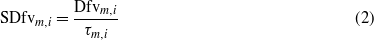
where Dfv is the deficit volume, τ is the threshold (Q80m,i), Q is the simulated streamflow, and SDfv is the standardized deficit volume. Subscripts i and m denote per grid cell (0.5°) and per month respectively.
Drought frequency was derived by counting the occurrences of drought events, i.e. when streamflow falls below the threshold Q80, and it was indexed by dividing it by the average frequency over the period 1960–2010 for pristine conditions to express the relative increase due to human water consumption.
In addition, the population size experiencing below 80% of normal streamflow conditions (Q80) was calculated as a measure of the number of persons affected by severe hydrological droughts per year. This population size was calculated per grid cell, but was summed over the globe and for each continent. The selection of the threshold is rather arbitrary, but is based on the experience that 80% of normal streamflow condition or rainfall amount historically causes severe drought conditions (Wilhite 2000, Wilhite and Glantz 1985).
2.2. Analysis of drought intensification due to human water consumption
To assess the impact of human water consumption on drought intensity and frequency, we performed three analyses (table S1 in the supplement available at stacks.iop.org/ERL/8/034036/mmedia). The first run evaluates streamflow under climate variability and with no human water consumption (hereafter, pristine), while the second run evaluates streamflow under variable climate inputs and with human water consumption set to the level of 1960 (hereafter, 1960 consumption), and the third run is subject to the reconstructed water consumption over 1960–2010 (hereafter, transient consumption). We calculated Q80 or the threshold values from simulated mean monthly streamflow (i.e., river discharge) under pristine conditions over the period 1960–2010. The threshold level Q80 derived from the pristine condition was then used to compute the deficit volumes for streamflow subject to varying degrees of human water consumption: pristine conditions, 1960 consumption and transient consumption. The increase in ensuing deficit volumes calculated compared to the pristine condition is thus an indicative of the anthropogenic intensification of hydrological drought. From these runs, we also analyzed the frequency of hydrological droughts as a result of human water consumption relative to the pristine conditions, and calculated the number of people affected by hydrological droughts worldwide over the period 1960–2010.
2.3. Model simulation of streamflow
The state-of-the-art global hydrological and water resources model PCR-GLOBWB was used to simulate spatial and temporal continuous fields of streamflow and storage in rivers, lakes, reservoirs and wetlands at a 0.5° spatial resolution for the period 1960–2010 (Wada et al 2010, van Beek et al 2011). In brief, the model simulates for each grid cell and for each time step (daily) the water storage in two vertically stacked soil layers and an underlying groundwater layer. At the top a canopy with interception storage and a snow cover may be present. Snow accumulation and melt are temperature driven and modeled according to the snow module of the HBV model (Bergström 1995). To represent rain–snow transition over sub-grid elevation dependent gradients of temperature, ten elevation zones was made on each grid cell based on the HYDRO1k Elevation Derivative Database, and scaled the 0.5° grid temperate fields with a lapse rate of 0.65 ° C 100 m−1. The model computes the water exchange between the soil layers, and between the top layer and the atmosphere (rainfall, evaporation and snowmelt). The third layer represents the deeper part of the soil that is exempt from any direct influence of vegetation, and constitutes a groundwater reservoir fed by active recharge. The groundwater store is explicitly parameterized and represented with a linear reservoir model (Kraaijenhoff van de Leur 1958). Sub-grid variability is taken into account by considering separately tall and short vegetation, open water (lakes, reservoirs, floodplains and wetlands), soil type distribution (FAO Digital Soil Map of the World), and the area fraction of saturated soil calculated by the Improved ARNO scheme (Hagemann and Gates 2003) as well as the spatio-temporal distribution of groundwater depth based on the groundwater storage and the surface elevations as represented by the 1 km × 1 km Hydro1k data set.
The model runs with a daily time step, but simulated streamflow is evaluated per month for this study. Simulated specific runoff from the two soil layers (direct runoff and interflow) and the underlying groundwater layer (base flow) is routed along the drainage network based on DDM30 (Döll and Lehner 2002) by using the kinematic wave approximation of the Saint-Venant equation (Chow et al 1988). The effect of open water evaporation, storage changes by lakes, and attenuation by floodplains and wetlands are taken into account. Streamflow may be reduced by upstream human water consumption from all sectors (households, industry and agriculture). When in a grid cell the available streamflow is less than the water consumption, no streamflow returns. Otherwise, the streamflow in excess of the local water consumption is accumulated along the drainage network.
A reservoir operation scheme is also implemented, which is dynamically linked with the kinematic routing module. This reservoir scheme optimizes for each reservoir the release given its purpose by defining the monthly target storage for the next two operational years to ensure its proper functioning given the forecasts of inflow and downstream demand along the drainage network. The target storage determines the daily outflow from reservoirs, and is updated as actual daily inflow and demand start to deviate from the long-term expected value. Four types of reservoir operations are distinguished on the basis of the reservoir data from the GLWD dataset (Lehner and Döll 2004), being water supply, flood control, hydropower generation, and others (e.g., navigation). In total we considered 513 reservoirs of the 654 reservoirs included in the GLWD dataset for the world's largest reservoirs (storage capacity ≥ 0.5 km3). The selected reservoirs represent 94% of the area of 255 109 km2 and 95% of the capacity of 4615 km3 contained by the GLWD dataset. The missing reservoirs cannot be truthfully represented given their limited size and catchment area and the required information on their purpose and characteristics is lacking.
The model was forced with daily fields of precipitation, reference (potential) evapotranspiration and temperature. For the period 1960–2000, precipitation and temperature were prescribed by the CRU TS 2.1 monthly data set (Mitchell and Jones 2005), which was subsequently downscaled to daily fields by using the ERA40 re-analysis data (Uppala et al 2005). The precipitation data was corrected for snow undercatch bias over the Northern Hemisphere (Adam and Lettenmaier 2003). Over the same time period, prescribed reference evapotranspiration was calculated based on the Penman–Monteith equation according to the FAO guidelines (Allen et al 1998) using the time series data of CRU TS 2.1 with additional inputs of radiation and wind speed from the CRU CLIM 1.0 climatology data set (New et al 2002). This was subsequently downscaled to daily fields on the basis of the daily temperature from the ERA40 re-analysis data. To extend our analysis to the year 2010, we forced the model by a comparable daily climate fields taken from the ERA-Interim re-analysis data (Dee et al 2011). We obtained daily fields of GPCP-corrected precipitation and temperature (GPCP: Global Precipitation Climatology Project; www.gewex.org/gpcp.html), and calculated reference evapotranspiration by the same method retrieving relevant climate fields from the ERA-Interim dataset. For compatibility with our overall analysis, we bias-corrected this dataset (precipitation, reference evapotranspiration and temperature) by scaling the long-term monthly means of these fields to those of the CRU TS 2.1 data set, wherever station coverage by the CRU is adequate (≥2 stations). Otherwise the original ERA-Interim data were returned by default.
2.4. Calculating human water consumption
Over the period 1960–2010, human water consumption, i.e. water withdrawal minus return flow, was reconstructed at monthly time steps on a 0.5° global grid for agricultural (livestock and irrigation), industrial and domestic sectors using the latest available data on socio-economic (e.g., total, urban and rural population, Gross Domestic Product and access to water), technological (e.g., energy and household consumption and electricity production) and agricultural (e.g., the number of livestock, irrigated areas, crop factor and crop growing season) drivers (Wada et al 2011a, 2011b). Return flow from water that is withdrawn was assumed to occur to the river system on the same day. Neither water retention due to waste water treatment nor the degradation of water quality after water is withdrawn was considered in this study. However, the quality of water is generally degraded after water is withdrawn particularly in regions with limited sewage and water treatment facilities. This effect is partly accounted for by including the number of population who have access to water, which was used to calculate the amount of return flow from the domestic sector (Wada et al 2011a). Nevertheless, water pollution affects the amount of readily available water over a region and the calculation presented here may potentially underestimate the human impact (i.e., water quality) on hydrological drought.
When estimating sectoral water consumption we explicitly accounted for nonrenewable groundwater abstraction (groundwater abstraction minus groundwater recharge) and desalinized water use as an additional source of human water consumption that is not imposed on the renewable water resources (streamflow). Note that nonrenewable groundwater abstraction is estimated with a simplistic, flux based, approach (Wada et al 2012) and the model does not consider increased capture due to decreased groundwater discharge and increased recharge from surface waters due to groundwater pumping (Bredehoeft 2002, Shamsudduha et al 2011). The actual amount taken from the simulated streamflow is then the minimum of the estimated net total consumptive water use, i.e. total consumptive water use minus nonrenewable groundwater abstraction and desalinated water use, and the available streamflow, already diminished with any upstream consumption. The calculated human water consumption has been validated in earlier work (Wada et al 2011a).
A map of estimated total human water consumption from domestic, industrial, agricultural sectors for the year 2010 is shown in figure S1 (see supplementary material available at stacks.iop.org/ERL/8/034036/mmedia). Estimated global water consumption totals 1970 km3 yr−1, where the agricultural sector consumes the largest amount, 1403 km3 yr−1, with industrial and domestic sector consuming 294 and 273 km3 yr−1, respectively. Over the period 1960–2010, human water consumption increased almost two and a half times. This increase is attributable to a drastic rise in irrigation water consumption, which almost doubled over the past 50 years (from 828 to 1403 km3 yr−1). However, industrial water consumption nearly tripled over that period (from 116 to 294 km3 yr−1), while domestic (households') water consumption more than quintupled (from 57 to 273 km3 yr−1) due to rapid population growth and increased standard of living.
3. Results
3.1. Comparison of simulated and observed drought deficit volumes
Figure 1 compares simulated drought deficit volumes as calculated under pristine conditions and under transient human water consumption, with those calculated from observed streamflow. We selected 23 large river basins over different climate zones of the world, and considered drought events for each available GRDC station along these rivers. Figure 1(a) provides a scatter plot of all events of all rivers. Under pristine conditions, the simulated deficit volumes are underestimated with α (slope or regression coefficient) of 1.3 and R2 (the coefficient of determination)= 0.5 (p-value < 0.001). Under transient human water consumption, α becomes close to 1 with R2 = 0.75 (p-value < 0.001). Including human water consumption results in smaller deviations between simulated and observed deficit volumes per drought event, and significantly reduced the residual variance of simulated deficit volumes (pristine over transient) (F-test = 1.2, p-value < 0.05). We also tested whether the change in those slopes (1.3 → ∼1.0) indicates statistically a significant improvement in terms of simulated deficit volumes based on an analysis of variance (ANOVA). The residual variances of both simulations (pristine conditions and transient consumption) are adjusted in advance, assuming equal residual variances. The results rejected both line coincidence (F-test > 100, p-value < 0.001) and line parallelism (t-test <− 7, p-value < 0.001), but show nearly equal intercepts (t-test ≈ 0.92, p-value > 0.25). These results indicate that the improvement in simulated deficit volumes after accounting for human water consumption is statistically significant. We then considered for extreme drought events whether this improvement is also evident. Extreme events were particularly chosen because they are usually related to meteorological extreme and the human impact on such drought events is less well known. We compared simulated and observed deficit volumes for the five worst drought events per river basin (figure 1(b)). The (cumulative) frequency distributions of R2 and α show that under transient human water consumption more than half of the rivers have R2 over 0.6 and α between 0.75 and 1.25 respectively, while under pristine conditions, half of the rivers have R2 just above 0.2 and α between 0.5 and 1.5 respectively. These results clearly show the importance of human water consumption in explaining observed both minor and major hydrological drought events. Further validation and discussion including basin-specific statistics are given in table S2 and figure S2 (see supplementary material available at stacks.iop.org/ERL/8/034036/mmedia).

Figure 1. (a) Comparison of per drought event simulated deficit volumes (m3) under pristine conditions (climate variability only) and under transient human water consumption with those calculated from observed streamflow in a logarithmic scale over 23 major river basins that are affected by human water consumption. The observed streamflow was taken from the selected GRDC stations closest to outlets. (b) Frequency distribution of correlation coefficient and slope per river basin from (a). Five worst drought events were selected from each of 23 major river basins. Note that for fair comparison, deficit volume was calculated with the threshold level Q80 that was derived respectively from each streamflow time series: from the GRDC observations; from the simulated streamflow under pristine conditions; from the simulated streamflow under transient human water consumption. River basins (GRDC stations; station number; available period used) selected: Orinoco (Puente Angostura; 3206720; 1960–1990), Parana (Corrientes; 3265300; 1960–1992), Nile (El Ekhsase; 1362100; 1973–1985), Blue Nile (Khartoum; 1663100; 1960–1983), White Nile (Malakal; 1673600; 1960–1996), Orange (Vioolsdrif; 1159100; 1964–1987), Zambezi (Katima Mulilo; 1291100; 1964–2002), Murray (below Wakool Junction; 5304140; 1960–2002), Mekong (Mukdahan; 2969100; 1960–1994), Brahmaputra (Bahadurabad; 2651100; 1969–1993), Ganges (Hardinge Bridge; 2646200; 1965–1993), Indus (Kotri; 2335950; 1967–1980), Yangtze (Datong; 2181900; 1960–1989), Huang He (Sanmenxia; 2180700; 1960–1989), Mississippi (Vicksburg; 4127800; 1960–2000), Columbia (The Dalles; 4115200; 1960–2000), Mackenzie (Norman Wells; 4208150; 1961–2002), Colorado (Yuma; 4152050; 1965–1990), Volga (Volgograd Power Plant; 6977100; 1960–2002), Dnieper (Dnieper Power Plant; 6980800; 1960–1985), Danube (Ceatal Izmail; 6742900; 1960–2002), Rhine (Rees; 6335020; 1960–2002), Elbe (Wittenberge; 6340150; 1960–2002).
Download figure:
Standard image High-resolution image3.2. Human intensification of hydrological drought intensity
We compared, for several exceptional nation- and continent-wide drought events, simulated standardized deficit volumes under pristine conditions with those subject to transient human water consumption (figure 2 and S3 available at stacks.iop.org/ERL/8/034036/mmedia). Over North America, particularly the US, the 1988 (figure S3) and 2002 (figure 2) droughts were among the worst, primarily due to a persistent El Niño–Southern Oscillation (ENSO), with record low rainfalls during spring and summer (Trenberth et al 1988, Seager 2007). Our results show that with human water consumption drought intensities increased substantially by 50%–500% over the western, central, and eastern US, southern Canada, and central Mexico, where human water consumption appears to be the main driver causing the drought event for both years. Over Europe, the intensification of drought conditions is milder than that over the US due to lower human water consumption, but it is still substantial over central and southern parts of the region under major drought events such as those of 1976, and 2003. Over these regions, the drought conditions are driven primarily by human water consumption. We find that the intensification of droughts is driven by industrial and households' water consumption (≈70–90% of total water consumption) over west-central Europe, including the UK, Germany, France and The Netherlands, while it is caused primarily by irrigation water consumption (>70% of total consumption) over southern Europe, including Spain, Italy, and Greece. The magnitude of the intensification is 10%–200% for the year 1976, but it rises to 40%–300% due to increased human water consumption for the year 2003. Over Asia, during the major drought of 2001, the intensification of droughts was most severe over India, Pakistan, Afghanistan, Uzbekistan, Turkmenistan, and north-eastern China, where irrigation water consumption exceeds 90% of total water used (Wada et al 2012). For these regions, drought intensities increased by 200%–500% as a result of substantially reduced local and downstream flow. Importantly, severe drought conditions over India and Pakistan are driven by human water consumption, whereas those over Afghanistan and Turkmenistan are caused by climatic conditions. For selected droughts in Oceania (2006), human water consumption has smaller impacts over limited areas, with the strongest impact over the Murray-Darling basin, where droughts intensified by 20%–200% due to large irrigation water consumption (figure S3). Over South America (2010) and Africa (1984) the impact of human water consumption during drought events is limited, except for several countries where human water consumption is still substantial, such as Egypt, South Africa, Chile, and Argentina (>10 km3 yr−1).

Figure 2. Comparison of standardized deficit volumes (—) with (left) pristine condition and with (middle) transient human water consumption, and (right) relative contribution of human water consumption (%) for major drought events over (a)–(c) North America (2002), (d)–(f) Europe (2003), and (g)–(i) Asia (2001). We tested whether the change due to human water consumption is significant by calculating the standard error from observed and simulated standardized deficit volume (under transient human water consumption) for all drought events over each basin (see supplementary material, available at stacks.iop.org/ERL/8/034036/mmedia). We used the average standard error over all basins as an estimate for all drought events. We then compared the change to two times average standard error (p-value < 0.05) to test the significance. Areas with significant change are highlighted with dark-gray lines.
Download figure:
Standard image High-resolution image3.3. Human intensification of hydrological drought frequency
Figure 3 compares the evolution of drought frequency under pristine conditions (climate variability only), with that under 1960 water consumption, and under transient water consumption, over the globe and for each continent. Trends of drought frequency under pristine conditions reflect multi-decadal climate variability, with globally a decrease of frequency from the 1960s into the 1980s and an increase thereafter. This global signal is from a combination of drought frequency in North America (high frequency–low frequency–high frequency), South America (high–low), Oceania (high–low–high) and Africa (increasing frequency) over the period 1960–2010 (Sheffield and Wood 2011). The result shows that already around 1960 drought frequency was considerably enhanced by human water consumption. The widening gap in drought frequency between 1960 water consumption and transient water consumption indicates the intensification of drought frequency as a result of increased human water consumption over the period 1960–2010. In 2010, the global drought frequency of transient water consumption is higher by 27 (±6)% compared to pristine conditions. Human water consumption increases drought frequency by 35 (±7)% for Asia, by 20–25 (±5–6)% for North America and Europe and by 10–20 (±2–3)% for South America, Africa, and Oceania. Included in figure 3 is the population size (per year) experiencing conditions under 80% of normal streamflow for any given month during that particular year. Results are shown for the run with transient consumption. Although the increase in drought frequency is mild over the period 1960–2010, the global population under drought substantially increased from 0.7 billion in 1960 to 2.2 billion in 2010. This increase is primarily driven by rapid population growth and increased population density (per grid cell). At a regional scale, similar trends are found for Asia, North America, Africa, South America, and Oceania, where population numbers are steadily increasing. These results suggest that more and more people are vulnerable to droughts, despite the relatively regular drought occurrence over time. In Africa, the population under drought increased dramatically by 10 times from 50 million in 1960 to 500 million in 2010 due to both increased drought occurrence and population growth.

Figure 3. Time series of estimated global hydrological drought frequency with pristine conditions (climate variability only), with fixed consumptive water use of 1960 (1960 consumption), and with transient consumptive water use (transient consumption) over the period 1960–2010 over (a) the Globe, and for each continent; (b) Asia, (c) North America, (d) Europe, (e) Africa, (f) South America, and (g) Oceania. The frequency was derived from the sum of the number of drought events below threshold levels for each year over the globe and for each continent. The frequency was indexed per year by dividing the sum by the average drought frequency of the pristine condition over the period 1960–2010. Population under 80% of normal streamflow condition is plotted per year. Annual country population data was taken from FAOSTAT (http://faostat.fao.org/), and was spatially downscaled to 0.5° spatial resolution (Wada et al 2011b).
Download figure:
Standard image High-resolution imageTo investigate the sensitivity of estimated drought frequency (figure 3) to the different percentile threshold levels (Q70,Q80, and Q90), in figure 4 we plotted the evolution of drought frequency under pristine conditions and under transient water consumption that was derived with each percentile threshold over the period 1960–2010. The results indicate that indexed drought frequency under pristine conditions appear to be insensitive to the choice of the percentile threshold levels, although the absolute number of drought occurrence generally increases with higher percentile thresholds (Q90 → Q70). However, for transient consumption, indexed drought frequency tends to be higher with the lower percentile thresholds (Q70 → Q90) and the absolute number of drought occurrence also increase with higher percentile thresholds (Q90 → Q70). This trend is especially obvious for drought frequency calculated with Q90, that substantially deviates from those calculated with Q80 and Q70. These results suggest that the calculation of drought frequency appears to be sensitive to the choice of percentile threshold level (<Q80) and the inclusion of human water consumption.

Figure 4. Sensitivity of estimated hydrological drought frequency (figure 3) to the different percentile thresholds (Q70,Q80, and Q90) for pristine conditions (climate variability only) and for transient consumptive water use (transient consumption) over the period 1960–2010 over (a) the Globe, and for each continent; (b) Asia, (c) North America, (d) Europe, (e) Africa, (f) South America, and (g) Oceania. The frequency was derived from the sum of the number of drought events below threshold levels (Q70,Q80, and Q90) for each year over the globe and for each continent. The frequency was indexed per year by dividing the sum by the average drought frequency of the pristine condition calculated with each percentile threshold over the period 1960–2010.
Download figure:
Standard image High-resolution image
4. Discussion
This study reveals that the magnitude of hydrological drought intensity and frequency is largely underestimated when using streamflow under pristine conditions that have been widely used for model based hydrological drought assessments. When comparing nation- and continent-wide drought events simulated under pristine conditions and transient human water consumption, human water consumption intensifies the drought intensity by 10%–500%. The intensification is mainly attributable to irrigation which requires a large amount of water during cropping period, and reduces substantially downstream streamflow. However, the impact of industrial and households' water consumption on the drought intensification is substantial over the eastern US and western and central Europe.
Such intensified droughts likely have detrimental effects on our society and ecosystems, causing persistent low flow conditions. To briefly address the societal and environmental impacts of intensified hydrological droughts, we conducted a first-order analysis on cooling in thermal power plants (∼stream discharge), navigation (∼stream water height), and aquatic ecosystems (∼stream temperature) (see supplementary material for further details, available at stacks.iop.org/ERL/8/034036/mmedia). Figure S4 (available at stacks.iop.org/ERL/8/034036/mmedia) depicts the results of intensified hydrological droughts: (1) stream temperature increase due to decreased streamflow, (2) potential decrease in the amount of water available for cooling thermal power plants, and (3) decrease in stream water height due to reduction in streamflow. Water supply in populated regions with large households' water consumption, such as western and eastern US, central Mexico, and many parts of Asia, is also likely impacted (MacDonald 2010, Gleick 2010, Pederson 2012).
Part of the decreased streamflow can be buffered by increasing reservoir release in regions where infrastructure (e.g., dams) is present. The impacts of reservoir operations (∼water supply) are particularly strong for the rivers crossing major irrigated areas of the world with the number of existing reservoirs including the Nile, the Orange, the Murray, the Mekong, the Ganges, the Indus, the Yangtze, the Huang He, the Mississippi, the Colorado, and the Columbia. Over these regions, reservoir operations generally increase the release during the low flow period to satisfy the water demands downstream. This alleviates the hydrological drought condition downstream. For river basins with the number of reservoirs with hydropower generation and flood control (e.g., Huang He, Dnieper, and Volga), the seasonal amplitude of simulated streamflow tends to decrease, which also reduces the frequency of hydrological occurrence. For other river basins such as the Orinoco, the Parana, the Danube, the Rhine, the Dnieper, the Elbe, the Congo, the Niger, and the Zambezi, simulated streamflow is less impacted by reservoir operations because of small reservoir capacity and lower water demands. For the Brahmaputra, reservoir capacity is low despite the large water demands (>50 km3) and the low flow periods coincide with the growing season of irrigated crops (∼spring) which require large amounts of water. In this region, people are more vulnerable to hydrological droughts due to low buffering capacities. However, our scale of analysis (∼50 km by ∼50 km) does not comprehend local-scale adaptive response to drought; for example conjunctive use of surface water and groundwater, retention ponds, and water-saving practice (Grey and Sadoff 2007). Moreover, our modeling approach does not fully reflect regional agricultural practice in which farmers may adapt to drought conditions in order to reduce the water demands during the growing season, which may result in different cropping calendars and extents (e.g., different sowing times and crop growing seasons, length, and areas). These local-scale interventions and processes involved in drought resilience that operate well below the scale of our analysis are not accounted for, but play a vital role for enhancing the societal resistance to droughts.
Moreover, severe hydrological drought conditions aggravate groundwater overdraft, resulting in groundwater depletion over large irrigated regions (Scanlon et al 2012), e.g. western and central US, western Mexico, India, Pakistan, China, and Iran. This increased groundwater overdraft compensates, albeit temporarily, for decreased surface water availability (Taylor et al 2013).
In general, observed streamflow is used to derive an assessment of hydrological drought occurrence since it is vital to have a correct estimate of the flow duration curve, i.e. minimum and maximum flow. When peak flow is poorly reproduced, there is likely a considerable mismatch in simulating drought events. However, observed data are not available at large spatial extents but it is defined only at gauging stations (e.g., GRDC stations), though hydrological drought can be as extensive as regional to continental scales. To overcome this limitation, and to be able to separate out the effects of human water consumption the modeling approach was used. Since our modeling approaches employ a series of assumptions and various input data, there are number of limitations and uncertainties inherent to this study.
We note that streamflow estimates and the corresponding 80-percentile flow, Q80, can vary substantially among different global hydrological models and with different climate forcing (Gosling et al 2010, 2011, Haddeland et al 2011). In tables S3 and S4 (available at stacks.iop.org/ERL/8/034036/mmedia), we evaluated simulated monthly streamflow against available GRDC stations (www.bafg.de/GRDC). We considered simulated streamflow both under pristine conditions and under transient human water consumption, and compared average, minimum (low), and maximum (peak) streamflow derived from observed and simulated monthly streamflow. The effect of transient water consumption is clearly observable for the rivers crossing major irrigated areas of the world with the number of existing reservoirs including the Nile, the Orange, the Murray, the Mekong, the Ganges, the Indus, the Yangtze, the Huang He, the Mississippi, the Columbia, and the Volga. For the other river basins, the impact of human water consumption is less obvious, but still noticeable such as the Orinoco, the Parana, the Brahmaputra, the Danube, the Rhine, the Dnieper, and the Elbe. For the Amazon, the Congo, the Niger, the Zambezi, the Mckenzie, and the Lena, the river discharge is hardly affected because of lower human water consumption. For those river basins where human water consumption is large, the overall model performance (R2 and NSC) improves when considering human water consumption, except the Ganges where our general model performance is low. This improvement is particularly evident for simulated minimum streamflow and for river basins where the low flow periods coincide with the large seasonal water demands, e.g. the growing season of irrigated crops (e.g., Orange, Murray, Brahmaputra, Indus, and Huang He). When including all available GRDC stations with long streamflow records (table S4), the comparison of observed and simulated streamflow also show improved performance (slope and R2) when including human water consumption, but the maximum (peak) streamflow is hardly affected. Simulated streamflow, monthly actual evapotranspiration, and monthly total terrestrial water storage were also evaluated against GRDC observations, the ERA40 re-analysis data, and the GRACE satellite observations, respectively in earlier work (van Beek et al 2011, Wada et al 2012), and showed generally good agreement with them across the globe.
Furthermore, we validated simulated deficit volumes against those derived from observed streamflow for major river basins of the world. The comparison showed generally good agreement for most of the basins, yet large discrepancies occurred when simulated streamflow failed to reproduce well the peak flow and seasonal variability, regardless of high correlation obtained from comparison of monthly streamflow. For example, over the Congo, both the timing and deficit volume are not always well reproduced by our model, despite the good correlation between simulated and observed monthly streamflow (R2 = 0.95). For the Zambezi, although our simulated monthly streamflow does not compare well with observed monthly streamflow (R2 = 0.75,α = 0.47, and NSC =− 1.2), simulated drought characteristics and deficit volumes agree relatively well with those derived from observed streamflow. This is likely due to the fact that our simulated monthly streamflow reproduces well peak flows relative to low flows (see also supplementary material, available at stacks.iop.org/ERL/8/034036/mmedia).
Note that the model does not include any artificial water diversions such as aqueducts and inter-basin water transfer. Such diversions can supply additional water to satisfy part of human water consumption. In this study, human water consumption is subtracted from simulated streamflow that is routed through natural drainage network only. This means that in some regions where extensive diversion works are present (the US, India and China) the reduction of streamflow due to human water consumption is likely overestimated.
Moreover, the results largely rely on the accuracy of calculated human water consumption. The methods which we used to estimate sectoral consumptive water in this study were tested, and the corresponding results were validated against available statistics and estimates in an earlier study (Wada et al 2011a). They showed that estimated total water consumption compare well to available statistics for most of the countries over the period 1960–2000 with R2 ranging from 0.91 to 0.97. However, the estimates are uncertain over some countries such as Vietnam, Uruguay, El Salvador, Jamaica, Madagascar, and Trinidad and Tobago, where we underestimate the water consumption by 10–50%, and also Colombia, Estonia and Moldova, where we overestimate the water consumption by 10–40%. Validation of simulated consumptive water use (per sector) remains difficult due to a lack of reliable information in many regions of the world. A recent study by Anderson et al (2012) combined remotely sensed precipitation and satellite observations of evapotranspiration and groundwater depletion to estimate surface water consumption by irrigated agriculture in California's Central Valley. This approach may be promising and opens up new ways to measure surface water consumption, particularly over data poor regions.
Our results showed that the standardization of deficit volumes relative to the threshold level, Q80, works well for various regions under different climates, particularly to index the relative changes of the intensity of hydrological droughts over large spatial regions, and over a long-term period (e.g., decades). However, the standardization procedure creates missing values for intermittent streams where Q80 = 0. This problem is less obvious in our analysis since we used monthly rather than daily streamflow. To fully resolve the problem, lower threshold level or exceedance percentiles can be applied (Fleig et al 2006, van Huijgevoort et al 2012). Woo and Tarhule (1994), and Tate and Freeman (2000) tested threshold levels ranging from Q5 to Q20 for intermittent streams over Africa. van Huijgevoort et al (2012) applied different threshold levels based on different flow percentiles. In this study, we used Q80 globally since human water consumption is intrinsically linked to perennial streams. However, it is worth noting that soil moisture (i.e., green water) is the major source of global food production (∼80%) (Falkenmark et al 2009, Hoff et al 2010), while rainfed agriculture is rarely assessed in the context of human water needs. Global food demand has been increasing consistently as a result of a growing world population. This may even increase the reliance to rainfed agriculture in near future. The focus on blue water resources (i.e., surface freshwater) underexposes the effects of climate variability on global food production met by rainfed agriculture.
Human water consumption is expected to increase further due to growing population and their food demands (Gleick 2000, Alcamo et al 2003a, Wada et al 2013). In addition, some studies (Lehner et al 2006, Feyen and Dankers 2009) suggest that due to global warming hydrological drought will become more severe by the end of this century. The resulting further intensification of hydrological drought will have considerable impacts on society and ecosystem services (Döll et al 2009, Rodriguez-Iturbe et al 2011). At the same time, it is clear that managing water consumption is one of the more important mechanisms that facilitate adaptive responses to cope with drought conditions. For instance, over Asia good water and land management practices have a potential to increase irrigation efficiency, which will in turn decrease the substantial amount of water used for irrigation (Gleick et al 2010, Foley et al 2011). Investing and improving water technology (e.g., recycling) has also a good potential to reduce water consumption (Vörösmarty et al 2010) in many rapidly developing countries where water is scarce.
Acknowledgments
We cordially thank two anonymous referees and one anonymous board member for their constructive and thoughtful suggestions, which substantially helped to improve the quality of the letter. YW was financially supported by Research Focus Earth and Sustainability of Utrecht University (Project FM0906: Global Assessment of Water Resources). NW was financed by User Support Space Research Grant of the Netherlands Organization for Scientific Research (Contract number: NWO GO-AO/30). This research benefited greatly from the availability of invaluable data sets as acknowledged in the references.