

Abstract
Evaluation of CO2 flux from peatland soil respiration is important to understand the effect of land use change on the global carbon cycle and climate change and particularly to support carbon emission reduction policies. However, quantitative estimation of emitted CO2 fluxes in Indonesia is constrained by existing field data. Current methods for CO2 measurement are limited by high initial cost, manpower, and the difficulties associated with construction issues. Measurement campaigns were performed using a newly developed nocturnal temperature-inversion trap method, which measures the amount of CO2 trapped beneath the nocturnal inversion layer, in the dry season of 2013 at a drained tropical peatland near Palangkaraya, Central Kalimantan, Indonesia. This method is cost-effective and data processing is easier than other flux estimation methods. We compared CO2 fluxes measured using this method with the published data from the existing eddy covariance and closed chamber methods. The maximum value of our measurement results was 10% lower than maximum value of eddy covariance method and average value was 6% higher than average of chamber method in drained tropical peatlands. In addition, the measurement results shows good correlation with groundwater table. The results of this comparison suggest that this methodology for the CO2 flux measurement is useful for field research in tropical peatlands.
Export citation and abstract BibTeX RIS

Original content from this work may be used under the terms of the Creative Commons Attribution 3.0 licence. Any further distribution of this work must maintain attribution to the author(s) and the title of the work, journal citation and DOI.
1. Introduction
Peatlands represent one of the Earth's largest terrestrial carbon pools; despite only covering about 2%–3% of the Earth's land area, peatland stores up to one-third of global soil carbon (Murdiyarso et al 2010). Tropical peatlands (4.41 × 10⁵ km2) constitute over 11% of the global peatland area and store about 70 Gt of carbon (Page et al 2011, Miettinen et al 2012). The largest tropical peatland area is distributed across Southeast Asia, mainly in Indonesia (Page et al 2011), where peatlands have been seriously disturbed over the past two decades (Hergoualc'h and Verchot 2014). Over this period, peat swamp forest has been deforested, drained, and burned (Page et al 2002, 2011, Hooijer et al 2010, Miettinen et al 2011), primarily for the development of plantation area (Murdiyarso et al 2010). Drainage construction lowering the water table leads to enhancement of peat oxidation (Wösten et al 2008) and results in the steady release of CO2 from the peat soil to the atmosphere (Sundari et al 2012). Furthermore, an immense amount of CO2 is also released from the occurrences of intensive wildfires caused by uncontrolled land clearing activities (Sundari et al 2012, Hergoualc'h and Verchot 2014).
Two different methods have been employed to measure CO2 flux exchange between Indonesian tropical peatland ecosystems and the atmosphere: eddy covariance (Hirano et al 2007, 2009, 2012) and the chamber method (Inubushi et al 2003, Furukawa et al 2005, Hadi et al 2005, Jauhiainen et al 2005, 2008, Sundari et al 2012), each with associated advantages and disadvantages. The eddy covariance method measures turbulent fluxes over a relatively large area (up to 50 km2), on a tower at certain elevation above the vegetation. The limitations of this method among other are the high initial cost and the sophisticated data analysis that requires a trained investigator. The chamber method measures the flux by analyzing the accumulation rate within a chamber placed over the land surface. Compared with the eddy covariance method, this method has a lower cost, is easier to operate and can be used in remote areas. However, it accommodates only a small spatial scale of measurement and requires frequent maintenance.
Evaluation of CO2 fluxes among soils, vegetation and atmosphere is essential for the quantification and understanding of land-use and land-cover change effect, the carbon source or sink strength of ecosystems, development of a global carbon balance (Kutzbach et al 2007), and particularly to support the carbon emission reduction policies. Although a number of CO2 flux exchange studies in tropical peatland ecosystem have been performed, the quantitative estimates of its impact to global climate remain limited by sparse field data (Frolking et al 2011). Therefore, in the present study, we propose a cost-effective methodology; the nocturnal temperature-inversion trap method. This method measures the amount of CO2 trapped under the temperature inversion layer (TIL), which is employed as a huge virtual chamber. Almost similar principle also is applied in nocturnal boundary layer budget method, which estimates flux in larger estimation area (Stieger et al 2015). The newly proposed method in this study is expected to be a solution for cost, manpower, and construction issues in monitoring of tropical peatlands. Here we discuss the basic principles of the proposed method, criteria for data analysis, and comparison results of the CO2 flux data obtained from this method with the data from existing eddy covariance and chamber methods.
2. Methods
This study was conducted during the dry season of 2013 from the end of June to early November. The nocturnal temperature-inversion trap method was developed to measure the amount of CO2 flux emitted from soil respiration including microbial and root respiration, during nighttime under the TIL condition. The CO2 flux was measured by evaluating the rate of increase in the mixing ratio of CO2 (xCO2). Under the TIL conditions, the temperature gradually increases as a function of height, which ascends during nighttime until just before sunrise (Fochesatto 2015). Its formation is explained as follows: compared with the atmosphere above the ground, the soil surface absorbs and emits heat much more efficiently. After sunset, the ground soil surface starts to lose its heat by radiation, followed by the cooling of atmosphere next to the soil surface. The warmer atmosphere at higher altitude then forms the TIL. A clear sky is essential for TIL formation since it is disturbed under cloudy conditions by the cloud downward radiation that slows the cooling process of the ground soil surface. In addition to the surface radiation, the cooling process of the ground surface is controlled by its thermal conductivity, which increases with moisture content. Peat soil, characterized by its high moisture content, is cooled down during nighttime. Under calm weather conditions, the atmosphere near the ground surface is sufficiently stable that the CO2 is accumulated at the lower height.
A field measurement campaign was conducted at the Kalampangan site (2°19'12''S, 114°2'24''E, elevation 30 m above sea level), Sebangau district, 20 km southeast of Palangkaraya, Central Kalimantan, Indonesia. This location is a post-burned area located near to remaining tropical peat swamp forest between the Sebangau River and the Kahayan River with area >50 km2 (Hirano et al 2007). In 1995, the Indonesian government initiated conversion of 10 million ha peat swamp forest into rice cultivation under the Mega Rice Project. The program was unsuccessful and terminated in 1999, leaving the abandoned converted land. During development of this project, large-scale canal construction was undertaken (Ritzema et al 2014), resulting in excessive peat drainage and subsidence in this area. This site has relatively flat terrain and the vegetation is mainly dominated by fern (Stenochlaena, Belchnum, and Lygodium spp.), sedge (Cyperus, Scleria, and Eleocharis spp.) and young trees of 0.4–1 m height (Hirano et al 2012). The average windspeed during measurement was 2.9 m s−1. The volume of virtual chamber during nighttime measurement varied based on windspeed and the height of TIL. Considering the eddy covariance fetch in the same location (Hirano et al 2012), the volume of virtual chamber is in the range of 0.6–15 × 106 m3. The impact of advection in this study can be neglected since measurements was conducted over an area with flat terrain and a homogenous source (Stieger et al 2015). Moreover, Hirano et al (2012) found that nighttime net ecosystems exchange at this observation site was independent of wind speed (u*), thus the effect of advection was neglected.
The vertical distributions of xCO2 and temperature were measured by constructing a polyvinyl chloride (PVC) tower of 10 m height and 6 cm diameter in the field. Four CO2 (CO2 Engine K30-LN; SenseAir AB, Delsbo, Sweden) and temperature sensors (HIOKI 3442; HIOKI E.E. Corporation, Ueda, Japan) were attached to dataloggers (HIOKI LR5091; HIOKI E.E. Corporation) and installed at four different observation heights (hobs = 0.9, 2.5, 4.6 and 8.4 m). These sensors and loggers were powered by solar batteries. Calibration was carried out by connecting the gas inlets of all CO2 sensors with one plastic flow tube, and then injecting an air mass with a known CO2 concentration into the tube. Water level data loggers (Hobo U-20; Onset Computer Cooperation, Bourne, MA, USA) were used to measure the change of the groundwater levels at six different points at distances of 20–700 m from the tower, as shown in figure 1. Perforated PVC tubes were inserted into the ground, and the sensors were hung by plastic straps. A commercial weather station (RainWise, Trenton, ME, USA) was placed 3 m away from the CO2 tower. Windspeed and direction were measured at a height of 5 m from the ground.

Figure 1. Location of the nocturnal temperature inversion-trap method tower (red circle), chambers (red square), and water logger #1–#6(red triangle).
Download figure:
Standard image High-resolution imageSoil respiration was also measured by automatic closed chamber systems for 1 year (September 2012–August 2013). Two chambers made of acrylic plastic, 45 cm in width, length, and height were installed about 100 m away from the measurement tower and placed in two contrasting micro-topographies, hollow and hummock, which were separated in distance by 5 m and in height by 0.3 m. Hummocks form on dense tree roots and have higher elevation than their surrounding hollows (Sundari et al 2012, Duberstein et al 2013). The hummock and hollow chambers were inserted 5 and 15 cm into the soil, respectively, 1 d prior to the measurements to reduce the disturbance of pressure gradients in initial measurements. The automatic closed chamber systems were equipped using a programmable data logger (CR10X; Campbell Scientific Inc. Logan, UT, USA) and an infrared CO2 analyzer (LI840; Li-Cor Inc. Lincoln, NE, USA). In each chamber, an air fan with diameter of 3 cm was set to homogenize the CO2 concentration in the chamber. The chambers were closed for 10 min in every hour and the CO2 concentration was measured every 5 s during the 10 min period.
3. Results
The diurnal profiles of temperature and xCO2, averaged over all data (135 d), are shown in figure 2. The TILs were formed from 17:30 until 5:30 local time when the height profiles of temperature had positive gradients. The CO2 emitted from the ground soil was accumulated in the virtual chamber between the TIL top and the ground surface. The ground surface of the observation site was covered dominantly by fern, sedge, and young trees, about 1 m high. The daytime CO2 uptake of this vegetation reduced xCO2 at hobs = 0.9 m by 20–30 ppm relative to xCO2 at hobs = 2.4, 4.6 and 8.4 m. The CO2 uptake stopped just after sunset and the xCO2 at hobs = 0.9 m increased abruptly, inconsistent with xCO2 at hobs = 4.6 and 8.4 m. The peak in xCO2 occurred at around 5:00, which corresponds to the total amount of accumulated CO2 during the 12 h nighttime period.

Figure 2. Diurnal profiles of (a) temperature and (b) xCO2 at various observation heights.
Download figure:
Standard image High-resolution imageThe time series of xCO2 profile as a function of height is shown in figure 3. The total amount of CO2 trapped under the virtual chamber (ΔxCO2) was defined as the area between xCO2 profile at 5:00 from the ground to the top of TIL and the ambient xCO2 prior to accumulation, which was the xCO2 at hobs = 0.9 m before sunset at 17:00
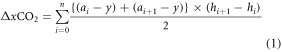
where y is xCO2 at 17:00, ai is xCO2 at 5:00 of observation point, i (=0−4), and h is the height of the observation point. a0 and h4 are estimated by extrapolation. The TIL height during measurement, hTIL can be determined when the xCO2 profile at 5:00 has the same value as the xCO2 at hobs = 0.9 m at 17:00. The hTIL tended to be stable between 1:30 and 5:30 when the increment of xCO2 was large enough to provide reliable height data.

Figure 3. Time series of xCO2 profile as a function of height. The ΔxCO2, trapped under the virtual chamber is defined as the area between xCO2 profile at 5:00 and 17:00 (the area bounded by the red dotted lines).
Download figure:
Standard image High-resolution imageThere are two factors that affect accumulation of CO2: (1) the temperature difference between the TIL top and the ground soil surface, which depends on solar intensity in daytime, and (2) the windspeed around the observation site. Since measurements were conducted in the dry season, solar intensity sufficiently strong for the formation of stable TILs, and hence the emitted CO2 was efficiently trapped when windspeed was low enough.
To determine criteria for our data analysis, raw data were classified into six ranges in relation to the temperature difference: ΔT(hobs) = T(8.4 m) − T(0.9 m). The classified criteria examined are ΔT > 1.5 °C to ΔT > 3.5 °C with 0.5 °C steps. In the following discussion, the criterion ΔT > 4 °C is excluded because it eliminates a large number of raw data, leaving only 14 d available for analysis of the 135 d measurement period while other criteria leave 34–118 d. Figure 4 shows the time series of xCO2 (hobs) for each ΔT, which peak at around 5:00, suggesting that the peak corresponds to the amount of CO2 accumulated in the natural chamber over the 12 h period. At the larger ΔT, since the atmosphere becomes stabilized, more CO2 is accumulated at the lower hobs (0.9 and 2.4 m).

Figure 4. Diurnal changes of xCO2 at various heights of (a) 0.9 m, (b) 2.5 m, (c) 4.6 m, and (d) 8.4 m and for each ΔT criterion.
Download figure:
Standard image High-resolution imageThe accumulated ΔxCO2 at 5:00 for each ΔT are shown in table 1. The larger ΔT results in the higher efficiency of accumulation because the more stable natural chamber is formed or vice versa. A weak inversion layer, or small ΔT, results in the highly scattered data with large standard deviations shown in table 1. Given that there is no appreciable change in the accumulated ΔxCO2 data under ΔT > 3.5 °C and >3.0 °C, the criterion ΔT > 3.0 °C was adopted for data analysis because of the smaller standard deviation and sufficiently large amount of data.
Table 1. Accumulated CO2 concentration for each temperature criterion.
| ΔT (°C) | Accumulated ΔxCO2 (ppm m/12 h) | Number of data |
 (ppm m/12 h) (ppm m/12 h) |
|---|---|---|---|
| >3.5 | 2500 | 34 | 990 |
| >3.0 | 2500 | 52 | 940 |
| >2.5 | 2400 | 77 | 2300 |
| >2.0 | 2100 | 118 | 3700 |
Soil respiration is strongly correlated with groundwater level (Sundari et al 2012); thus, the ΔT > 3.0 °C data were subdivided into five different periods during the measurement term, which correspond to different groundwater levels. Averaging the data for each period, figure 5 shows a negative correlation between the accumulated ΔxCO2 data and the groundwater level, suggesting that despite this method is relatively inexpensive, the present TIL data acquisition approach is adequate.

Figure 5. Time series of water level (red line) and average value of accumulated ΔxCO2 under the criterion of ΔT > 3.0 °C (gray line).
Download figure:
Standard image High-resolution image
The accumulated ΔxCO2 data for 21 d of data under the condition of ΔT > 3.0 °C depends on the windspeed. The accumulated ΔxCO2 were plotted as a function of windspeed. Extrapolating to a windspeed of 0, not shown here, the obtained intrinsic accumulated ΔxCO2 was 3700 ppm m/12 h or 1300 gC m−2 y−1.
Table 2 shows a summary of CO2 fluxes estimated from the proposed TIL method, the automatic closed chambers, and the previous studies by Sundari et al (2012) and Hirano et al (2012), which were conducted at the same measurement site. The TIL method and eddy covariance method have similarities in measuring the CO2 efflux from several heights above the ground. The maximum estimated CO2 flux data from the TIL method is 10% lower than with the maximum value of the eddy covariance method (Hirano et al 2012). However, the minimum and average values from this method were lower than the eddy covariance results, which may be caused by our selection of data for the dry season only, over only a few months. The average values from this method were 14% and 6% higher than chamber results in drained forest and 4% lower than the chamber result in undrained forest. Given that our TIL results for soil respiration represent a flux from peatland over a wide area, this represents the average respiration rate at the site.
Table 2. Comparison of our results with reported data at the same observation site.
| Method | Site | Micro-topography | # of observation points | Condition | Annual average soil respiration (gC m−2 y−1) |
|---|---|---|---|---|---|
| Temperature- | Drained burnt swamp forest | 1 | Nighttime | 1300 ± 390 | |
| Inversion trap methoda | |||||
| Hollow | 1 | Nighttime | 563 ± 360 | ||
| Chambera | Drained burnt swamp forest | Hummock | 1 | 1684 ± 418 | |
| Average | 1124 | ||||
| Hollow | 2 | All day | 1006 ± 119 | ||
| Hummock | 5 | 1444 ± 368 | |||
| Chamberb | Drained peat forest | Average | 1225 | ||
| Hollow | 2 | All day | 1016 ± 180 | ||
| Undrained peat forest | Hummock | 5 | 1678 ± 198 | ||
| Average | 1347 | ||||
| Eddy covariancec | Drained burnt swamp forest | 1 | Annual average ecosystems respiration | 1787 ± 92 |
4. Conclusion
Measurement of the atmospheric CO2 trapped between the nighttime TIL and the ground soil surface provides information about the respiration rate averaged over peatland across a wide area. Although its application is limited to calm night emissions in the dry season, it has advantages in low initial cost, automated measurement and easy analysis. With use of four CO2 sensors vertically separated on a 9 m plastic pole, the data analysis criteria appropriate for natural chamber formation are as follows: (1) a temperature difference between the highest and lowest sensor positions of >3 °C, and (2) windspeed dependence should be considered even when the average windspeed is as low as 3 m s−1. There was a negative correlation between CO2 fluxes estimated by this method and the groundwater level. The CO2 value measured using the nocturnal temperature-inversion trap method are in good agreement with the results of the chamber method and previously reported studies. Therefore, this method can be considered as a solution for the current cost, manpower, and site access issues associated with monitoring CO2 efflux in tropical peatlands. The CO2 emission from soil respiration using this method for Indonesian peatlands of 206 950 km2 (Page et al 2011) is roughly estimated to be 180–358 Mt C/y.
Acknowledgments
We thank Mr Y Sakurai of Nihon Koei for his help with the fieldwork. This work was sponsored by the Green Network of Excellence Programs and the Japan Science and Technology Agency (JST) of Ministry of Education, Culture, Sports, Science, and Technology, Japan. Development of this system was also supported by the JST-SENTAN System Development Program for Advanced Measurement and Analysis.